China launches two Beidou navigation satellites on single rocket
China has sent two Beidou navigation satellites into orbit on a single Long March-3B rocket, marking a first for the country’s satellite programme.
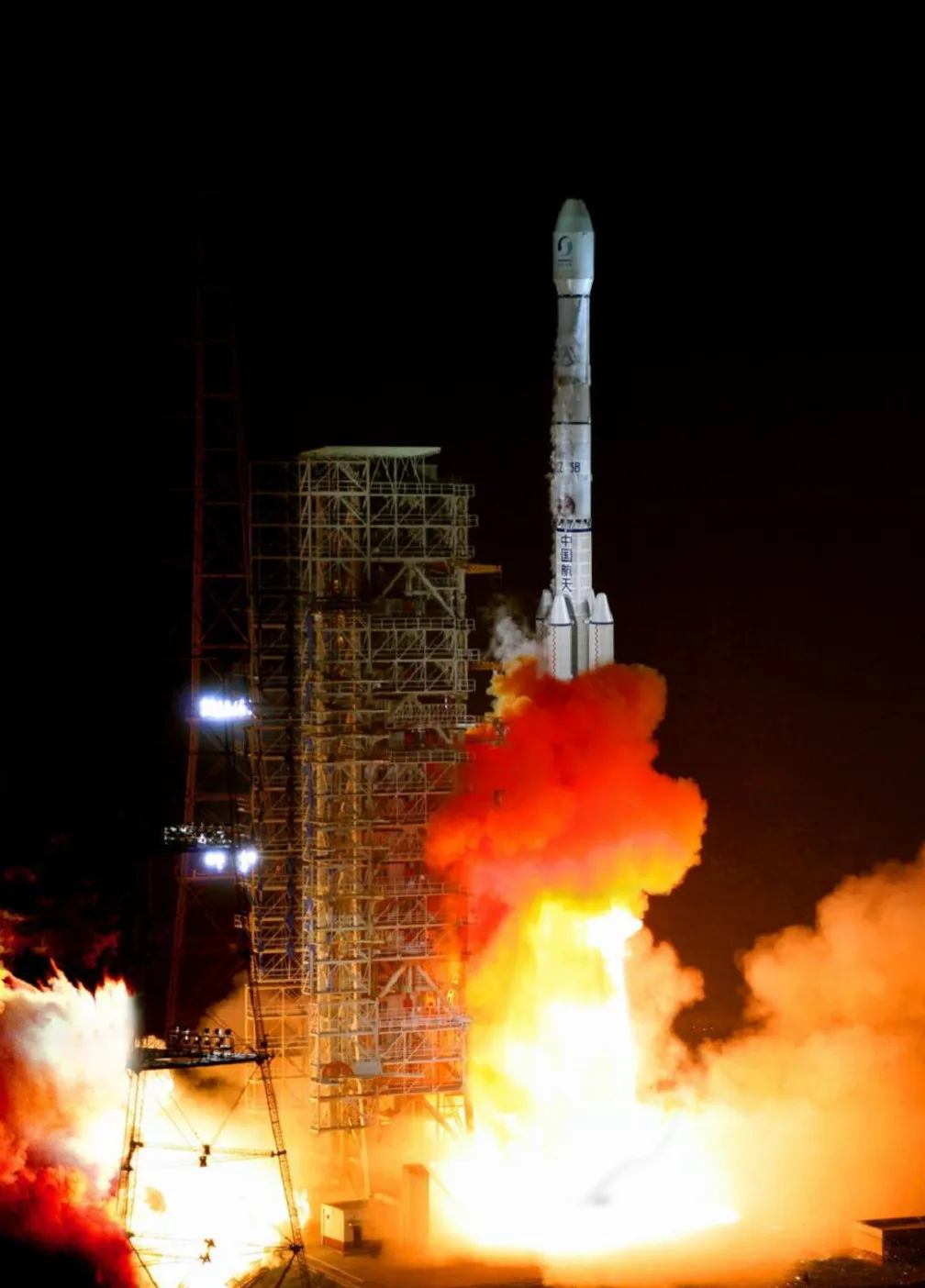
China successfully launched two navigation satellites for its Beidou global positioning system at 4.50am on Monday, 30 April 2012. Both satellites were sent into orbit by a Long March-3B rocket from the Xichang Satellite Launch Centre in Sichuan province. This launch marks a significant step in the expansion of China’s satellite navigation capabilities.
Overview of the Launch
Significance of the Dual-Satellite Launch
The mission is notable as it is the first time China has launched two navigation satellites aboard one rocket. This achievement highlights the growing sophistication of China’s space programme and its ability to deploy multiple satellites in one launch. Such progress is expected to accelerate the expansion of the Beidou network, allowing for faster deployment and improved coverage.
Beidou Network Coverage and Expansion
The Beidou system, also known as the Compass Navigation Satellite System (CNSS), began trial operations in December 2011. Its coverage stretches from the southern border of Russia to Australia, and from India in the west to the Pacific Ocean in the east. This area includes most of China, Southeast Asia, and parts of Oceania. The addition of these two satellites is expected to improve the accuracy and reliability of the system for users within this region.
| Northern Limit | Southern Limit | Western Limit | Eastern Limit |
|---|---|---|---|
| Southern border of Russia | Australia | India | Pacific Ocean |
According to official plans, China aims to complete the Beidou network by 2020. The completed system is projected to include more than 30 satellites, offering global coverage and providing an alternative to other satellite navigation systems such as the US-operated GPS and Russia’s GLONASS.
Technical Details of the Beidou System
- Second-generation satellite navigation system approved in 2004.
- Provides continuous, real-time passive 3D geo-spatial positioning.
- Enables speed measurement for users.
- Currently serves the Asia-Pacific region, with plans for global coverage.
Implications for Navigation and Technology
With the launch of these two satellites, the density of the Beidou network increases, which is expected to improve positioning accuracy and reliability for users in the covered regions. The system is designed to serve China’s domestic needs and to offer robust navigation services to neighbouring countries and the wider Asia-Pacific market. This development is particularly relevant for sectors such as transportation, logistics, and emergency services that rely on accurate and reliable positioning data.
For automotive manufacturers and suppliers operating in China and the neighbouring region, the expansion of Beidou could influence the design and compatibility requirements of navigation hardware and software. As the system matures and its coverage expands, compatibility with Beidou signals may become increasingly important for in-car navigation units, mobile devices, and connected vehicle services. International manufacturers wishing to sell navigation-enabled products in the Chinese market may need to ensure their devices can receive and process Beidou signals alongside GPS and GLONASS.
Strategic and Global Significance
The deployment of the Beidou system is part of China’s broader strategy to reduce reliance on foreign-controlled satellite navigation networks. By establishing its own independent system, China enhances its national security, economic competitiveness, and technological autonomy. The Beidou system is also positioned to support China’s growing presence in global technology markets and to provide services for international partners, particularly within the Belt and Road Initiative framework.
The ability to launch two satellites at once demonstrates advances in China’s launch technology and operational efficiency. This capability is likely to accelerate the pace of Beidou’s deployment, helping China to meet its target of global coverage by 2020. As the network grows, it is expected to play a larger role in international navigation and positioning services, offering users an alternative to existing systems.
Next Steps for Beidou Deployment
- Continue increasing the number of Beidou satellites in orbit.
- Enhance service reliability, signal strength, and positioning accuracy.
- Support broader international cooperation and integration with global systems.
- Expand applications in transportation, logistics, emergency response, and consumer electronics.
The successful dual-satellite launch from Xichang underscores China’s commitment to advancing its navigation infrastructure. As more satellites are added, users can expect improvements in service and broader compatibility with devices and services worldwide. The continued expansion of the Beidou network is likely to have lasting impacts on technology development and international cooperation.